Heat Wave in Montana
We set out for a week long adventure to explore the beautiful Glacier National Park in Montana. We flew into airport and got picked up by Brit’s family who we would be traveling with and drove a few hours father to our Airbnb destination in Kalispell, MT. Little did we know that the week we chose to be in Montana, a massive heat wave was rolling through the state. Just our luck as this trip was planned to be majority hiking centric. Temperatures soared to 90s and 100s which is almost unheard of for this part of the country. We were quite saddened as we typically enjoy escaping our hot and humid Midwest summers to enjoy the cool mountain air. Although we didn’t get the mountain weather we were longing for we sucked it up and took full advantage of being in one of the most beautiful areas of the country and explored and hiked as much as we could.
We stayed in an Airbnb about an hour away from Glacier National Park. Due to the park being in such a remote area and the popularity of the park, it can be difficult finding a budget friendly place that is closer in. But we found a great spot in Kallispell and the drive in wasn’t too bad. We were able to go to the park each day of our trip. Here are a few tips to consider if you’re planning a trip to Glacier
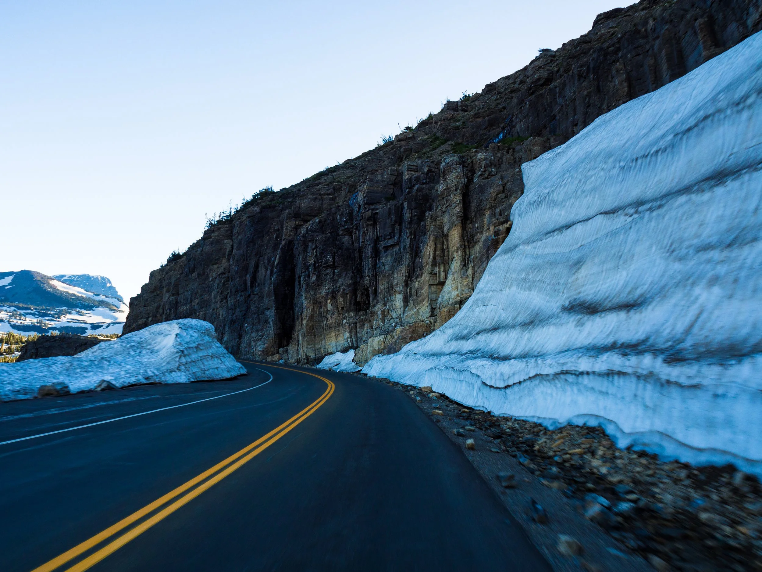
The Going to the Sun Road is a 50 mile road connecting the East and West ends of the park. This is the only road that traverses through the entire park. It takes about 2 hours to drive the entirty without stops and traffic. It gets very crowded during peak times and may back up with traffic quickly.
Reservations are reuqired to drive on the Going to the Sun road. You can purchase your reservaton at the NPS website. It is advised to reserver your spot early! The road is usually open anywhere from mid June through early September. Opening and closing of the road is weather dependent due to the heavy snowfall in Montana. During our trip in end of June, the road had just fully opened a couple days before we arrived.
Parking in Glacier gets very croweded due to the large crowd and limited roads and parking availability. It is advised to arrive to the park early! And be prepared to circle parking lots a few times before you can find a spot.
Although this road gets very crowded, it was still a highlight of the trip and definitely a must to drive the entire road if you’re planning a trip to Glacier. We were able to drive the road end to end many times during our stay. One of our favorite days was driving through and stopping off at many of the scenic overlooks. We had a picnic lunch at a particularly beautuful overlook. There’s nothing like getting to enjoy your lunch with a backdrop of some of the most majestic mountain scenery in the country. Some of our favorite spots along the road (from west to east) include:
Lake McDonald: This is a beautiful mountain lake with a campground, lodge and watercraft rentals. We stopped here to enjoy the beautiful views and tried some of Montana’s famous huckleberry ice cream at one of the shops in Apgar village. Huckleberries are a Montana specialty, growing wild in western Montana mountains. Throughout Montana you’ll find many different huckleberry treats such as huckleberry pie, ice cream, jams and coffee. McDonald lake is also a great spot to see Montana’s famous colorful rocks found in the water. We did not swim while we were there. But this a great place to cool off and swim in the chilly mountain water. Many people were taking advantage of the warm temps to enjoy a swim!
McDonald falls: A quick stop right after McDonald lake that offers a large parking lot and viewing platform.
West tunnel: features two large windows viewing upper McDonald creek valley and Heavens Peak. You cannot park at the tunnel but you can stop at a pull off before or after the tunnel and walk over.
The Loop: the biggest switchback on the Going-to-the-sun road. the loop offers great panoramic views of the surrounding mountains.
Haystack falls: about two miles up the road from the loop is the iconic waterfall that crosses underneath the road that you’re driving over.
Weeping wall: another amazing water feature along this road is the weeping wall which is a series of water falls “weeping” from the cliffside. If you roll down the windows you may get a little wet! The weeping wall was one of the most fun parts of the road to drive through.
Big Bend: literally a big bend in the road. A great place to take in the views of the mountains. However, the parking lot at this stop can get very crowded.
Triple Arches: one of the coolest engineering feats of this road. There are no parking spots nearby this feature so it can only be observed while driving.
Logan Pass: the highest point on the Going-to-the-sun road at 6,646 feet. This is the gateway to many of Glacier’s iconic trails such as the Hidden Lake trail and Highline trail. The Logan Pass visitor center is located here as well. Due to the popularity of this area of the parking gets very crowded very quickly. So be prepared! This is also one of the most common areas of the park to see bighorn sheep wandering the parking lot and nearby hillsides.
St Mary lake: the jewel of the eastern side of the park. This is the second largest lake of the park after Lake McDonald.
Wild Goose Island Overlook: A must stop destination to photograph the famous Goose Island.


Along with the many scenic overlooks, we were able to get many hikes in during our week in Glacier. We got a total of 45 miles of hiking accomplished! And we still didn’t do every trail. So this shows how much hiking is available throughout this park!. Here were some of our favorite hikes:
Trail of the Cedars (0.9 miles) and Avalanche Lake (5.9 miles): these hikes are located on the West end of the park just past Lake Mcdonald. We combined these two trails together as the trailhead for Avalanche lake is located about midway through the Trail of the Cedars. Trail of the cedars is an easy, wheelchair accessible walk through a lush forest of cedars and ferns. Walking through makes you feel as if you’ve been transported to the Pacific Northwest. Avalanche lake starts out along the Avalanche creek and Avalanche Gorge with stunning turquoise blue water. This is a beautiful and peaceful part of the trail and was one of our favorite areas of the whole park. As you continue on, you make it to Avalanche Lake. The views are very rewarding as you are surrounded by a beautiful mountain lake outlined with sheer cliffs of cascading waterfalls.


Hidden Lake Overlook trail (2.7 miles): This trail is located at Logan Pass. It features a boardwalk path that takes you to a vantage point of Hidden Lake. We were able to do most of the hike, but we were unable to get to the overlook due to a grizzly bear encounter! A grizzly and her two cubs were roaming close to the end of trail and a park ranger was thankfully there to halt all hikers from continuing. We got a little too close to the bears for comfort, so it was a little scary. The ranger did a good job calming the crowd and getting everyone out of harm’s way. Unfortunately, there was quite a large crowd and a few people attempting to run from the bear out of fear. Remember to never run from grizzly bears! Stay calm and always have bear spray ready in bear country. It was a little bit of a hectic journey back as we went almost single file back down a steep, snow covered hill. Some of the hikers decided to slide down the snowy hill. The trail ended up staying closed the remainder of the week we were there due to the bears staying in close proximity. We wanted to complete another trail in this area, but it was advised not to due to the trail being more remote and the higher amount of grizzly activity. Though we only got to explore a portion of the trail, it was very beautiful and definitely was a highlight of our trip. We definitely recommend hiking the whole trail as the bears allow! A less scary wildlife encounter on this trail was a very cute marmot that was posing for us and looking very majestic with the mountain background haha.


St Mary’s and Virginia Falls (3.1 miles): Located on the Going-to-the-sun road towards the east end. Two beautiful waterfalls can be seen on this hike. Virginia falls is about a mile farther down from St Mary’s. At the start of the trail, you hike through a forest that was burned in 2015. We had another wildlife encounter on this trail with a deer following us throughout the entire first mile or so of the hike. This was a wonderful hike and relatively short.


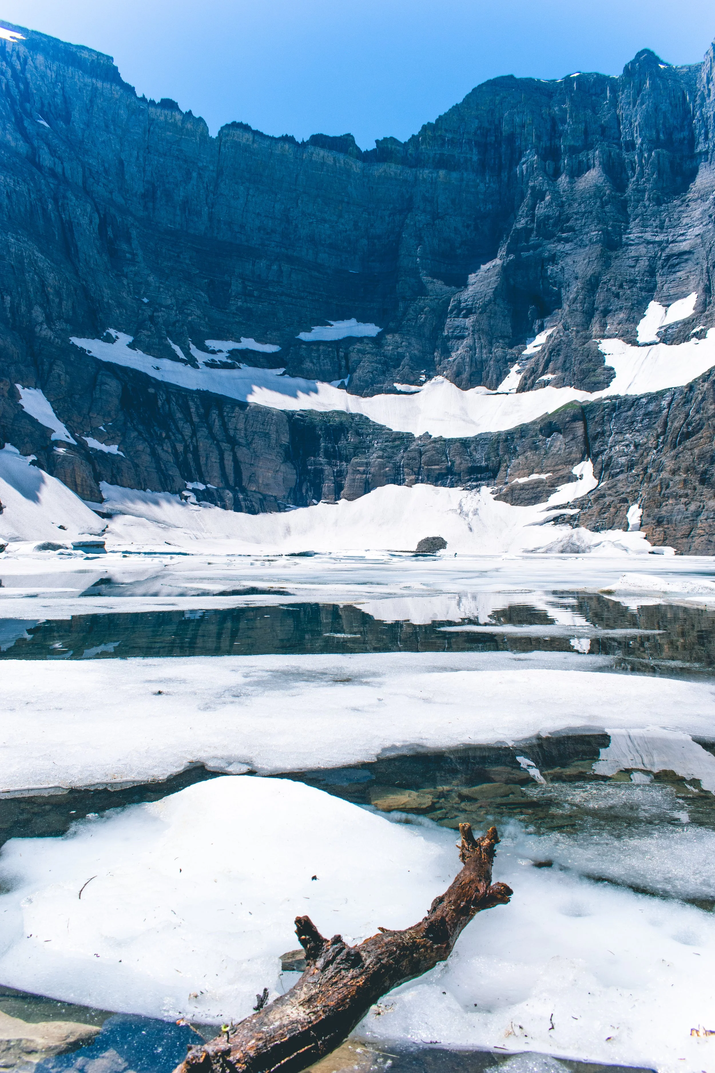
Iceberg lake (9.6 miles): this hike is located in the Many Glacier area of the park. At 9.6 miles, 1200ft elevation gain, and extreme heat, this was a rather challenging hike. The beginning of the hike takes you through lush forests and streams and then the trail opens up to valleys of wildflower meadows and panoramic mountain views. As you get towards the end of the hike you come to snowbanks that you hike through until you arrive at Iceberg lake. The snow was a nice treat to arrive to after hiking many miles through the heat. It was good opportunity to cool off with some snowball throwing. As you arrive at Iceberg lake you are rewarded with dazzling crystal blue water filled with floating icebergs. There were even some brave people (or maybe dumb haha) swimming in the glacial water.


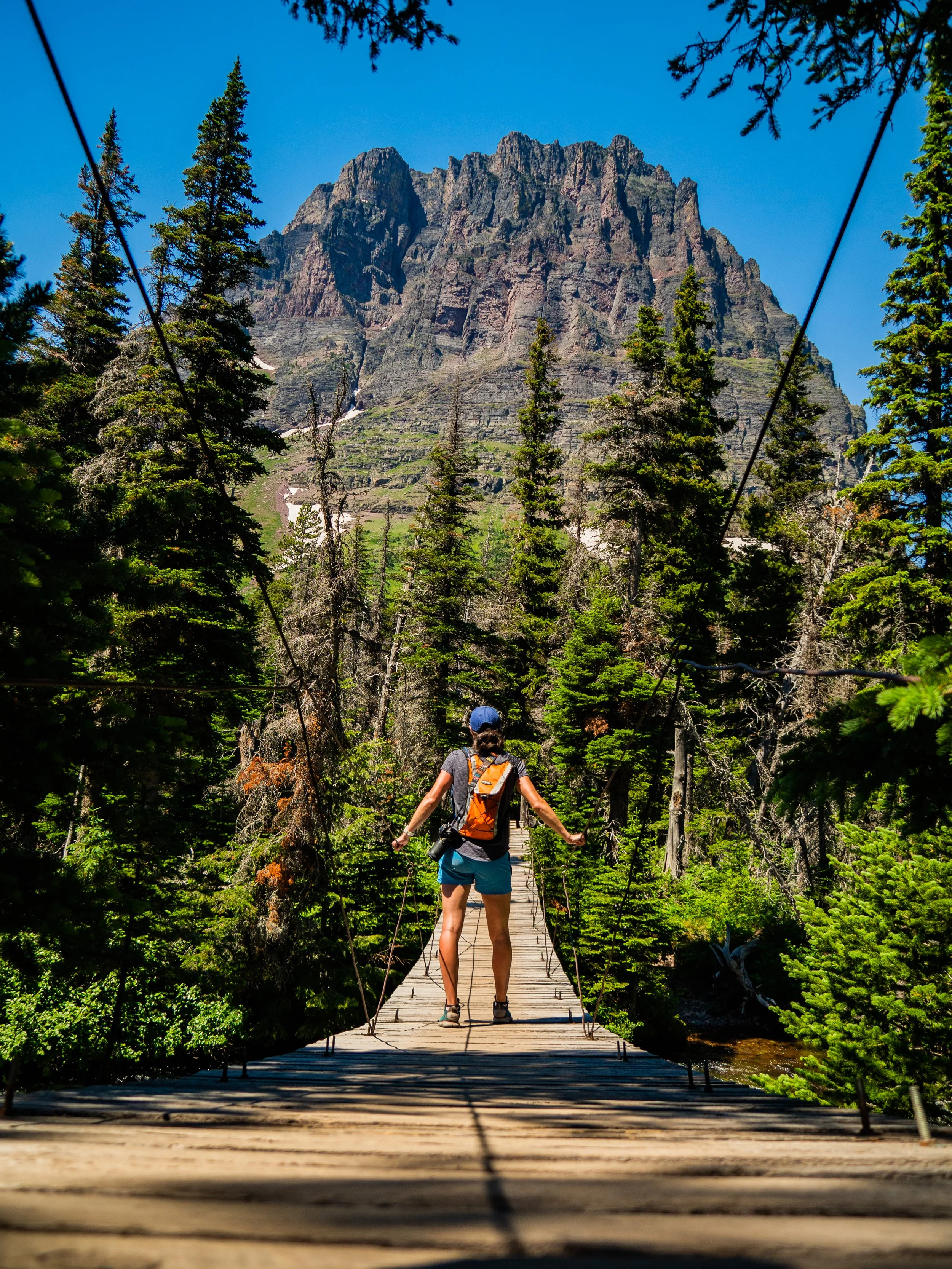
Rockwell falls (6.6 miles). This is a relatively easy and flat hike located in the two medicine area of the park on the east side. This hike starts at two medicine lake and takes you through forest and meadows of wildflowers. This hike features a suspension bridge and peaceful waterfall oasis at the end of the trail. We were even lucky enough to spot a moose on this trail at one of the ponds found along the trail!


Redrock falls (4.2 miles): This trail begins at the Swiftcurrent pass trailhead in the Many Glacier area. At about 1.7 miles you will reach Redrock lake. On the opposite side of the lake, sits Redrock falls. Once you reach the falls you can explore around the large red rocks that surround the falls and get to vantage points where you can view the upper and lower falls. This is an outstanding hike that is relatively short and relatively flat.


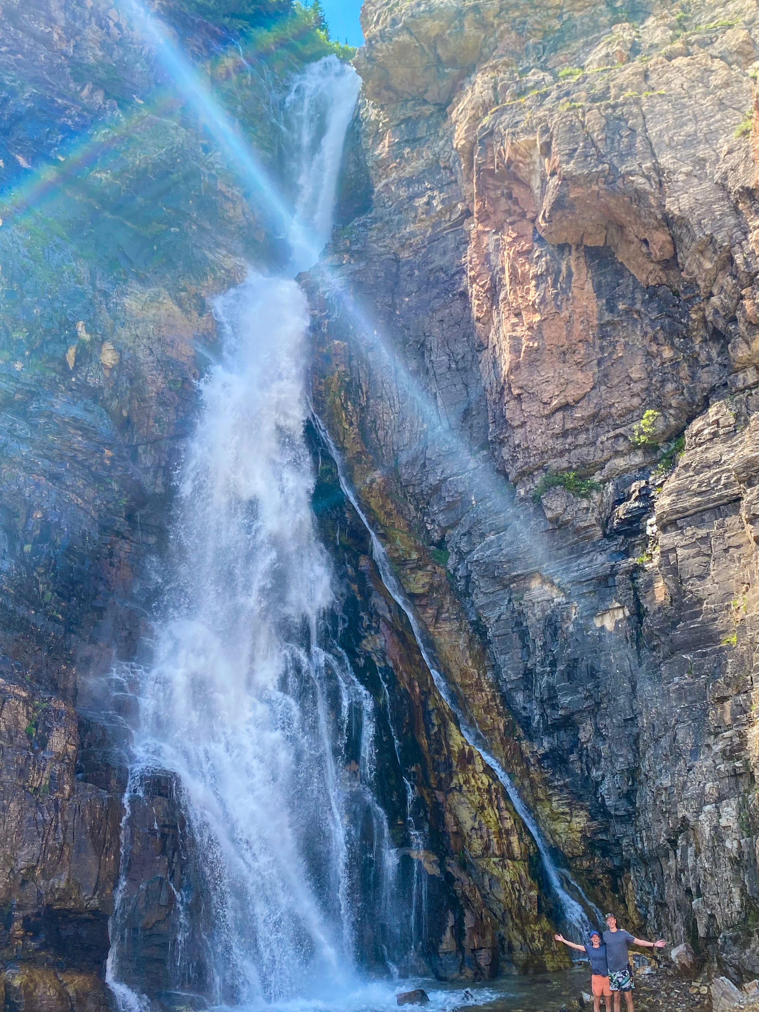
Apikuni Falls: Near the Many Glacier Area of the park, this hike is 1.8 miles roundtrip and 625 ft elevation gain. This hike is pretty steep so it can be challenging. Toward the end of the hike requires a little bit of scarmbling and climbing up rocks to get to the base of the waterfall. Standing at the base of the falls and looking up at the mighty falls rushing down was breathtaking.
We had an amazing time exploring the many natural wonders within Glacier National Park. We can understand why it is one of the most popular and crowded parks in the United States. We would definitely come back to explore this park again, maybe when it’s not quite so warm!


